Luzon is the largest and most populous island in the Philippines. It also refers to one of the three primary island groups in the country, and roughly divided into four sections: Northern, Central and Southern Luzon, and the National Capital Region. Among these, Northern Luzon has the most diverse ethnolinguistic groups such as the Cordillerans of the highlands and Ilocanos of the lowlands.
Cordillera Administrative Region (Ilocano: Rehion/Deppaar Administratibo ti Kordiliera; Tagalog: Rehiyong Pampangasiwaan ng Cordillera), designated as CAR, is an administrative region in the Philippines situated within the island of Luzon. The only landlocked region in the insular country, it is bordered by the Ilocos Region to west and southwest, and by the Cagayan Valley Region to the north, east, and southeast. Highlighted are provinces I’ve visited for this trip.
The Ilocos Region (Ilocano: Rehion/Deppaar ti Ilocos; Pangasinan: Sagor na Baybay na Luzon; Tagalog: Rehiyon ng Ilocos) is an administrative region of the Philippines, designated as Region I, occupying the northwestern section of Luzon. It is bordered by the Cordillera Administrative Region to the east, the Cagayan Valley to the northeast and southeast, and the Central Luzon to the south. To the west lies the South China Sea. Highlighted is the province I’ve visited for this trip.
It was first month of the year 2020 so I spent my vacation leaves on visiting Northern Luzon. This time, I went to Dominion Bus Terminal in Cubao, Quezon City to start my journey, as part of my #project81.
Cagayan Valley or Region II is an official administrative region in the Philippines located in the northeastern portion of Luzon Island. It is composed of five Philippine provinces: Batanes, Cagayan, Isabela, Nueva Vizcaya, and Quirino. The region hosts four chartered cities of Cauayan, Ilagan, Santiago, and Tuguegarao. Highlighted are the province I’ve visited for this trip.
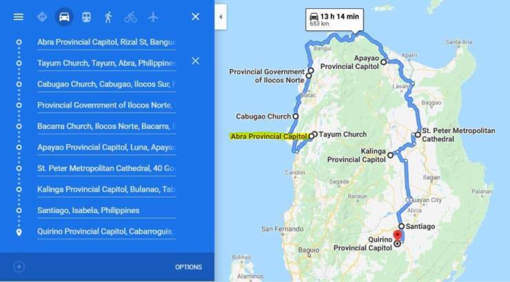
I have visited some parts of Ilocos Region and Cagayan Valley before so this will be my first time to visit Abra and neighboring provinces within Cordilleras. Hence, my itinerary became Northern Luzon Arch Solo Trip! Presenting my itinerary below with Bangued (Abra Capitol) as entry and Cabarroguis (Quirino Capitol) as exit point:
My Northern Luzon ArchTravel Map doing clockwise route from Bangued, Abra.
HIGHLIGHTS PER REGION:
CORDILLERA ADMINISTRATIVE REGION designated as CAR Abra 📍Abra Provincial Capitol 📍Saint James the Greater Cathedral 📍Bangued Municipal Hall 📍San Lorenzo Ruiz Shrine 📍Bangued Town Plaza 📍Victoria Park
📍Cassamata Hill National Park
📍Quintin Paredes House
📍Bangued Heritage Houses
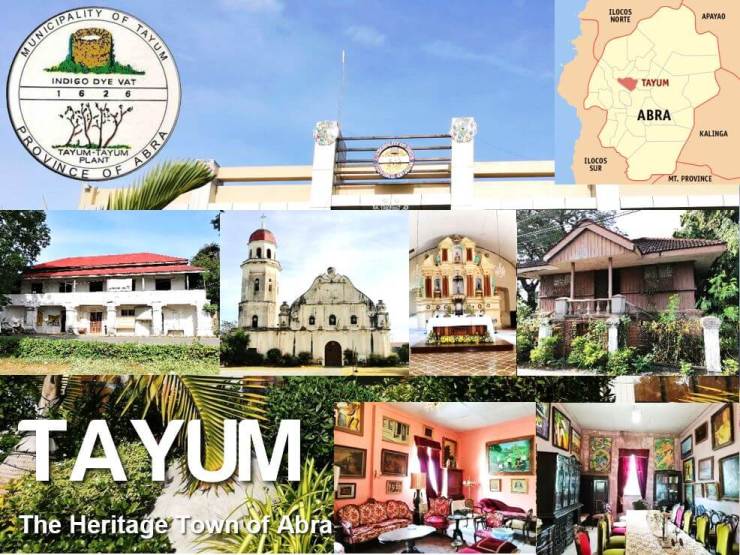
📍Tayum Municipal Hall
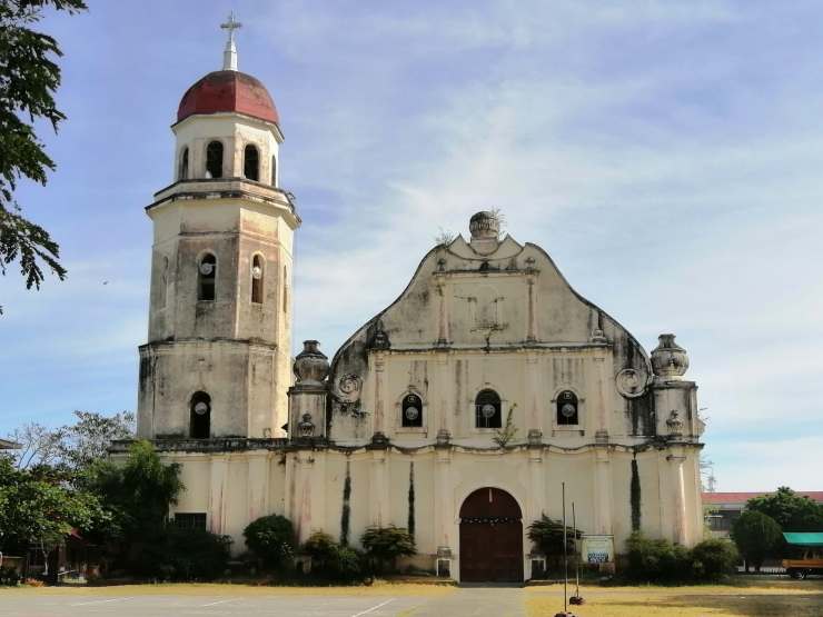
📍Saint Catherine of Alexandria Parish Church declared as a National Cultural Treasure 📍Gabriela Cariño-Silang Gallery of Fine Arts
📍Holy Spirit Convent (Tayum Old Municipal Hall)
📍Mary Barbero Park
📍Teodoro Brillantes Ancestral House
📍Tayum Heritage Houses Apayao
📍Apayao Provincial Capitol
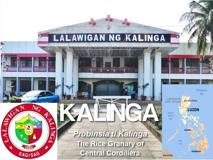
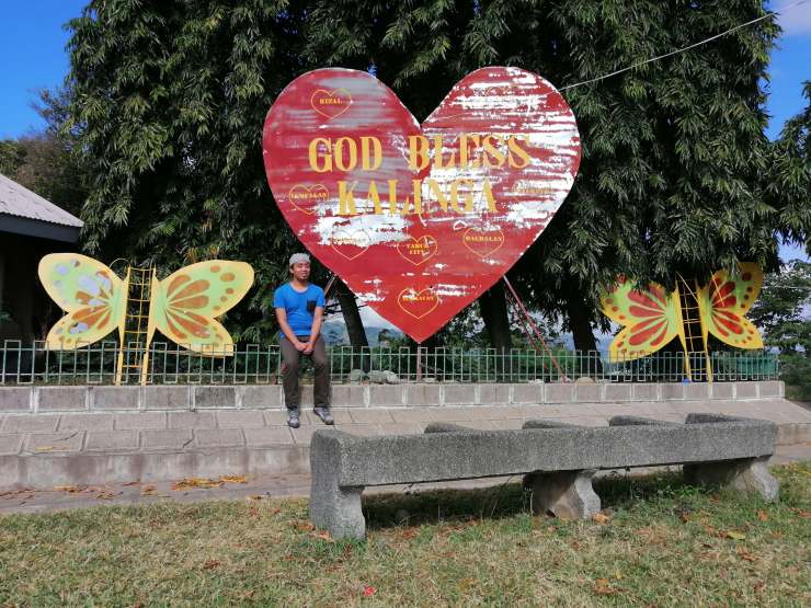
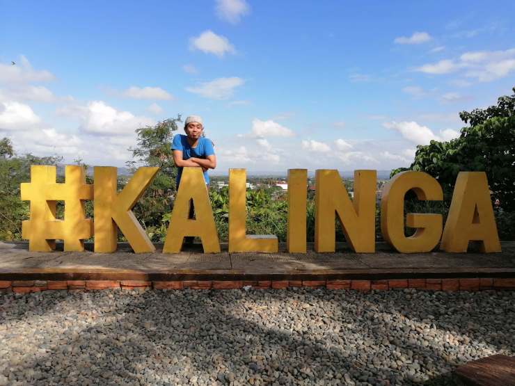
📍Capitol Park Kalinga
📍Kalinga Provincial Capitol
📍St. William’s Cathedral
📍Capitol Park
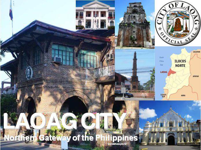
ILOCOS REGION designated as Region I Ilocos Norte
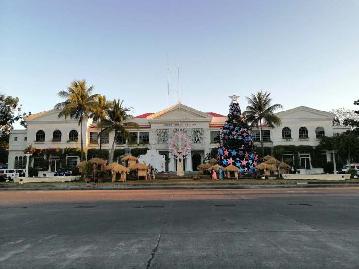
📍Ilocos Norte Provincial Capitol
📍Laoag City Hall
📍Saint William’s Cathedral
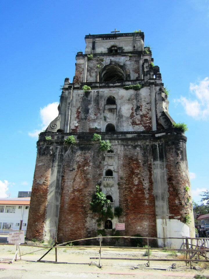
📍Laoag Sinking Bell Tower declared as a National Cultural Treasure
📍Aurora Park
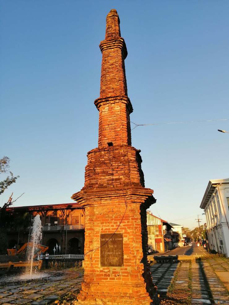
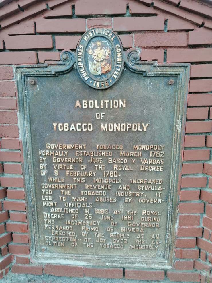
📍Abolition of Tobacco Monopoly Monument and Historical Marker
📍Museo Ilocos Norte
📍Laoag City Public Market
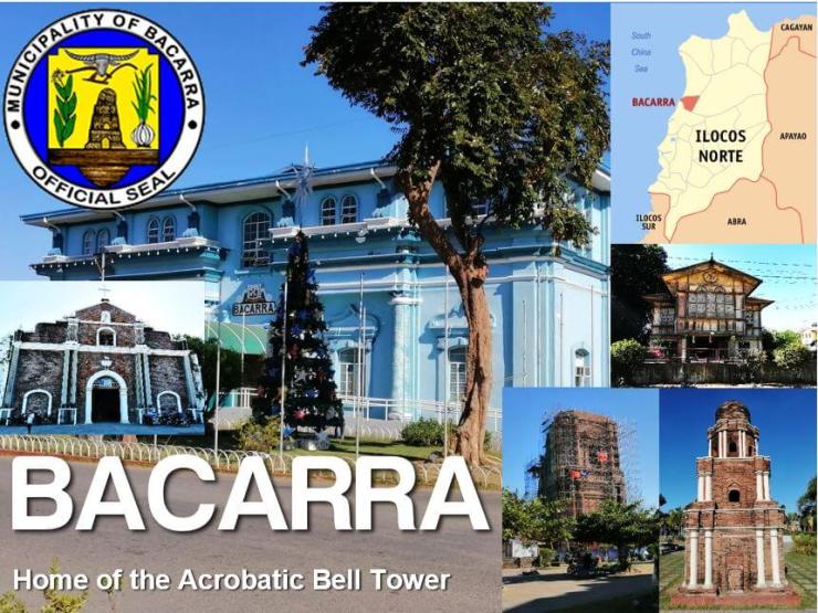
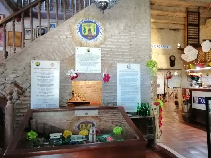
📍Bacarra Municipal Hall
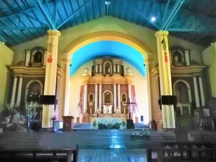
📍Saint Andrew Parish Church declared as a National Cultural Treasure
📍Bacarra Domeless Belfry declared as a National Cultural Treasure
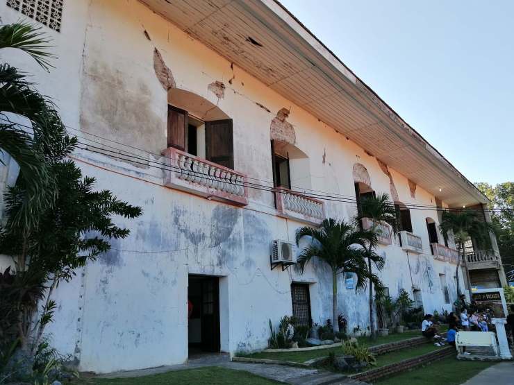
📍Museo de Bacarra
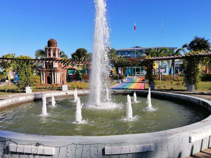
📍Bacarra Public Plaza
📍Bacarra Heritage Houses
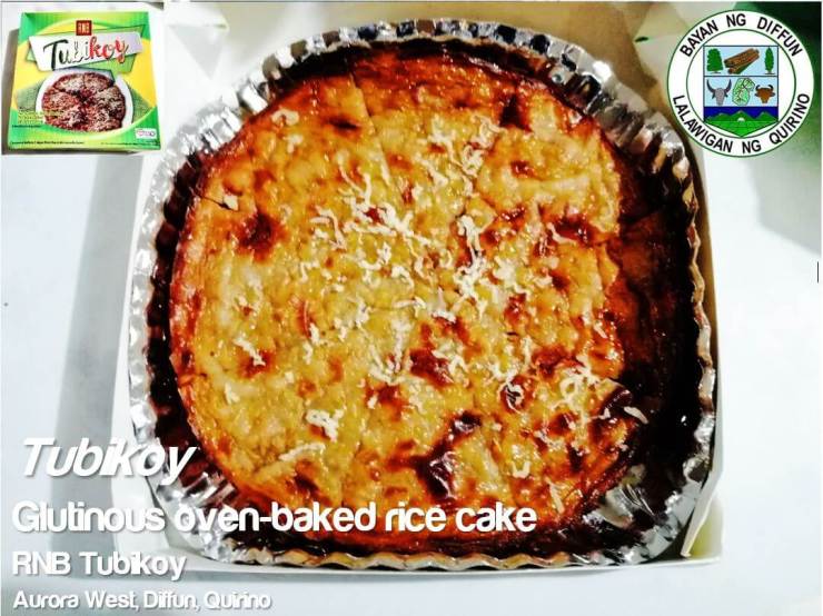
CAGAYAN VALLEY designated as Region II Cagayan 📍St. Peter Metropolitan Cathedral 📍Cagayan Museum and Historical Research Center 📍Rizal Park Quirino 📍Quirino Provincial Capitol 📍Quirino Museum 📍RnB Tubikoy at Diffun
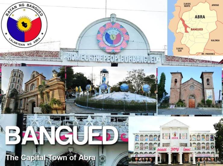
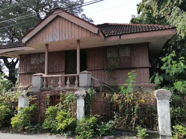
Abra (Ilocano: Probinsia ti Abra; Tagalog: Lalawigan ng Abra) is a landlocked province of the Philippines in the Cordillera Administrative Region in Luzon. Its capital is Bangued, and is bordered by Ilocos Norte on the northwest, Apayao on the northeast, Kalinga on the mid-east, Mountain Province on the southeast, and Ilocos Sur on the southwest. The name of the province originated from the story when Spaniards were successful in their attempt to penetrate the inner communities in the east by removing the obstacles, saying in Spanish “Abra esos obstáculos” and it was in that happening when they developed the area and established the towns and barangays. The place where they found many obstacles, they named it “Bangen” and the province they called it “Abra”. My 62nd province!Bangued, officially the Municipality of Bangued (Ilocano: Ili ti Bangued; Tagalog: Bayan ng Bangued), is a 1st class municipality and capital of the province of Abra, Philippines. The name “Bangued” means “roadblock”. It was established as a regular town in 1598 and was made the seat of the provincial government of Abra on July 25, 1861. The inauguration coincided with the feast day of Saint James the Great.The Roman Catholic Diocese of Bangued (Lat: Dioecesis Banguedensis) is a Roman Rite diocese of the Latin Church of the Catholic Church in the Philippines. Its territory is the whole province of Abra.Nave of the cathedralMain altarSan Lorenzo Ruiz Shrine stands a few kilometers away from the city plaza. It stands next to a cemetery, making this a mortuary chapelAncestral house of statesman Quintin Paredes
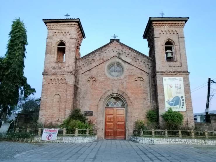
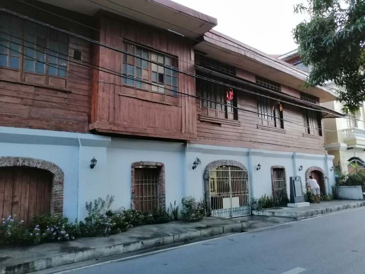
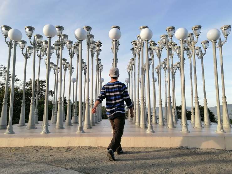
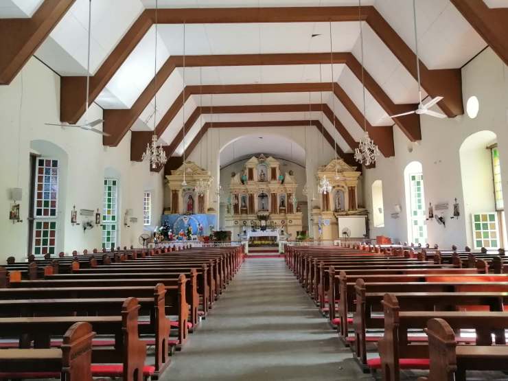
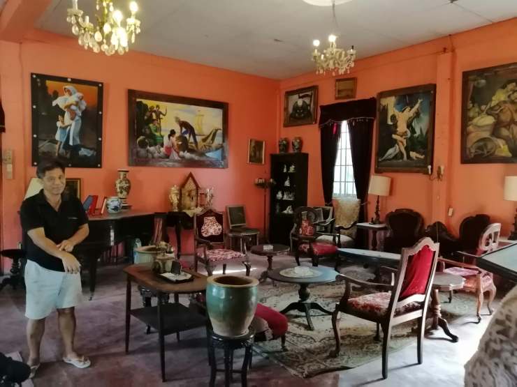
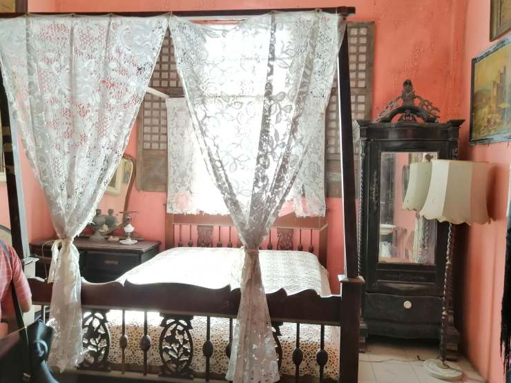
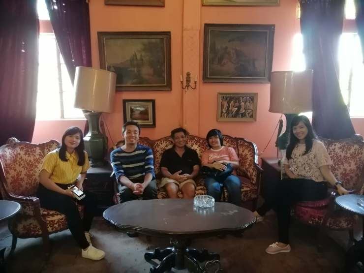
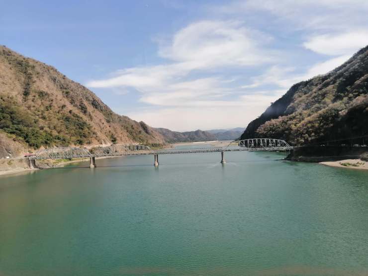
Our Lady of Victory at a viewing deck of Victoria Park. From here you can see Bangued.Lamp posts attraction at Victoria ParkAbra LandmarkAbra Miki is a type of noodle soup dish prepared with miki noodles on a rich pork and chicken stock colured with annatto seeds and topped with cripsy pork and egg. It is common in Northern Luzon particularly in the province of Abra. A variant of Pancit Miki, it is in either soupy or fried version.Masa podrida are traditional Filipino shortbread cookies made from flour, salt, baking powder, brown sugar, shortening, and eggs. It has a dry crumbly texture similar to half-moon cookies. The name comes from Spanish for “rotten flour”. Masa podrida are typically eaten with coffee and other hot drinksTayum, officially the Municipality of Tayum, (Ilocano: Ili ti Tayum; Tagalog: Bayan ng Tayum), is a 5th class municipality in the province of Abra, Philippines. Records show that Tayum got its name after the indigo plant which was commonly known to the Ilocanos as Tayum-Tayum. There was a time when indigo flourished in Tayum, then a source of wealth to the Ilocanos.Parish Church of Santa Catalina de Alejandria of Tayum – The church is predominantly Baroque in style. The curved pediment ends smoothly into two large volutes which seat beside two, large, urn-like finials. The pediment is surmounted by a huge, knob-like finial. To the right of the façade stands the four-tiered bell tower with its rectangular base and octagonal upper levels. The church of Tayum, unlike the majority of Spanish-era churches in the country, was founded and built by Secular priests to Christianize the native group Tinguians in the region during the 19th century.The Santa Catalina de Alejandria Parish Church (Spanish: Iglesia Parroquial de Santa Catalina de Alejandría), commonly known as the Tayum Church, is a 19th-century Baroque church located at Brgy. Poblacion, Tayum, Abra, Philippines.The parish church, under the patronage of Saint Catherine of Alexandria, is under the jurisdiction of the Roman Catholic Diocese of Bangued.The church, together with 25 other Spanish-era churches, was declared a National Cultural Treasure by the National Museum of the Philippines in 2001.Old Tayum Municipal HallTeodoro Brillantes Ancestral HouseGabriela Cariño-Silang Gallery of Fine Arts with the curator Sir Chato. This is a must-visit when you’re in Tayum, Abra. You’ll be amazed by vast collection of his father and the stories behind these art pieces, from Renoir paintings to antique furniture and many more.The bed used by Gabriela Silang when she took refuge in Abra.Me sitting on Thai King’s throneFellow museum visitors from Ilocos SurCrossing Lagben River with Old Quirino bridge in sightIlocos Norte (Ilocano: Amianan nga Ilocos) is a province of the Philippines located in the Ilocos Region. Its capital is Laoag City. Its name originated from story when Miguel Lopez de Legazpi’s grandson, Juan de Salcedo began looking for sites to conquer. As they sailed along the coast, they were surprised to see numerous sheltered coves (looc) where the locals lived in harmony. As a result, they named the region Ylocos and its people Ylocanos. I first visited this way back 2012 so this is my 12th province!Laoag, officially the City of Laoag (Ilocano: Siudad ti Laoag), is a 3rd class component city and capital of the province of Ilocos Norte, Philippines. It is the province’s political, commercial, and industrial hub and the location of the Ilocos Region’s busiest commercial airport. The name of the city “LAOAG” is a derivation of the Ilocano term “lawag”, which means light/brightness. According to history, Laoag has a clear, blue skyline. It was from this premise, perhaps, that the place was given the name “Laoag.”Aurora Park at nightIlocos Norte Provincial CapitolAbolition of Tobacco Monopoly Monument and Historical Marker – Built in 1881 as a way of thanking King Alfonso XII of Spain by the people of Laoag for abolishing the tobacco monopoly.
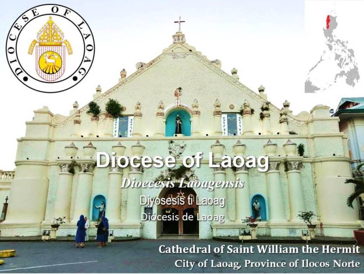
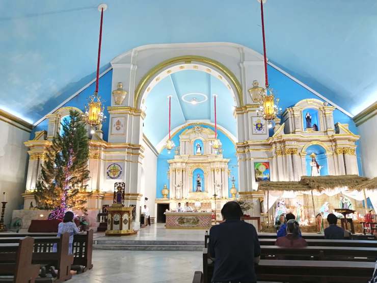
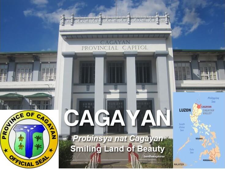
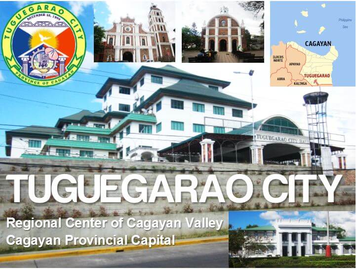
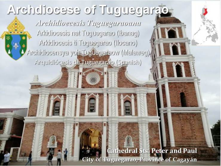
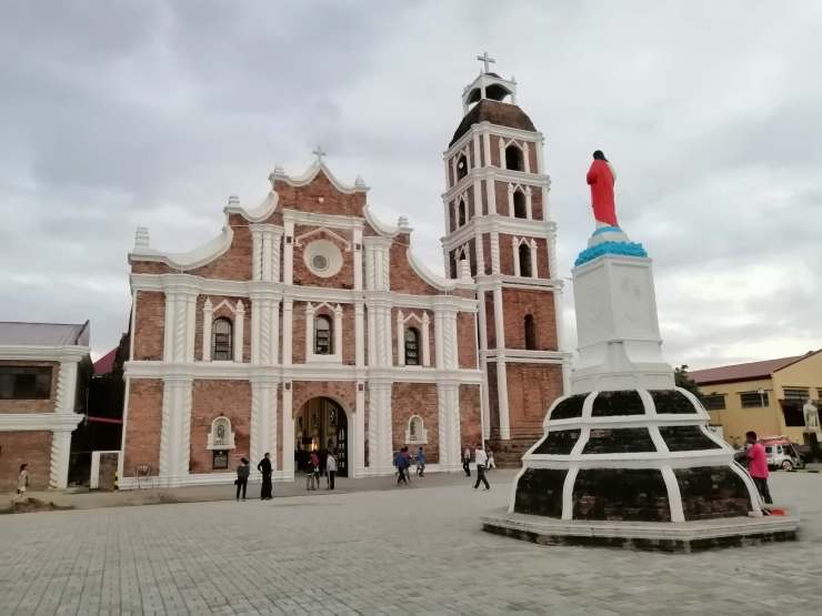
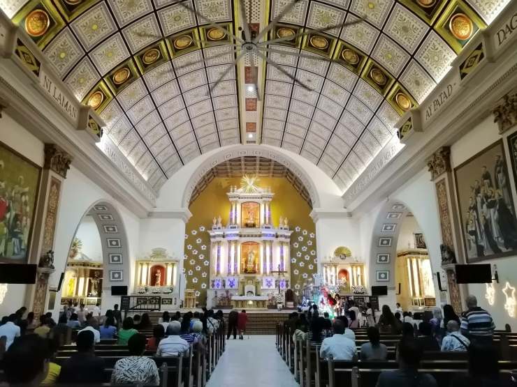
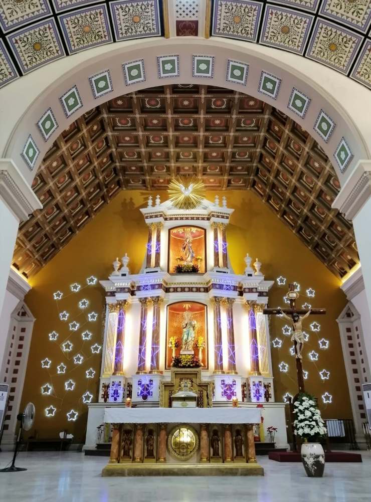
Laoag Cathedral, canonically known as Saint William’s Cathedral (Spanish: Catedral de San Guillermo) is a church in Laoag City, Ilocos Norte, Philippines. The current church was built in 1612 by Augustinian friars to replace a wooden chapel. It also serves as the seat or central church of the Roman Catholic Diocese of Laoag.The church is known for its Italian Renaissance design. It also has an unusual two-storey façade, supported by two pairs of columns on each side of the arched entrance. The top of the façade holds a recessed niche that showcases the image of the city’s patron saint, San Guillermo el Ermitaño. It has windows made from capiz with wrought iron screens.Belfry of San Guillermo Cathedral in Laoag – The famous “Sinking Bell Tower” sinks into the ground at a rate of an inch a year. It has survived several minor earthquakes since its construction, causing scholars to label it an Earthquake Baroque style structure. The tower, built presumably after the 1707 earthquake, has a foundation of 90 metres (300 ft). It used to have a large clock on the tower’s western face. This was declared as a National Cultural Treasure under Watchtowers of Ilocos Norte.Like Batac and Vigan versions, Laoag empanada is also made of grated papaya, mung beans, and egg—then wrapped in rice flour and finally, deep-fried. Stuffing with longganisa can be optional—and perhaps what spells the difference is the type of longganisa used. At JVM Sweet Empanada, it was perfectly cooked—not overdone, not flaky nor dry. The stuffing is slightly sweet, which is complemented by the remarkable vinegar.I should have tried Pancit Lusay but it was not available that time so I ordered this instead. It was savory and I liked it.Bacarra, officially the Municipality of Bacarra, is a 3rd class municipality in the province of Ilocos Norte, Philippines. It was dubbed as Balikbayan Town of the Philippines, Vatican of the Philippines and home of the “Dignified Domeless Bell Tower in Asia”.The name Bacarra has two legendary origins. One legend tells of a native fisherman who was out fishing in what is now known as the Bacarra River. Two Spanish soldiers promenading the place had asked the fisherman about the name of the place. Not understanding what the soldier meant, jubilantly answered “Bacbacarra, Señor”.The Spanish went away with the thought that Bacarra was the name of the place. Another related story was the coining of a by-word of a farmer and his wife who were making big basket called “Bakar” which was used as rice basket. From these two legends, the Spaniards associated it with the town into its present name which is “BACARRA”, the same place where most of the Bacarreños now live.Parish Church of Saint Andrew of Bacarra – Bacarra Church was originally founded by the Augustinians and dedicated it to St. Andrew. It is known for its centuries-old and domeless leaning bell tower. The church and an adjoining convent were established in 1593. In 1973 President Ferdinand Marcos declared the church a National Cultural Treasure through Presidential Decree No. 260.The three retablosThe church museum, known as Museo de Bacarra, is housed in the former church convent. The two-story restored convent, which dates to the Spanish colonial era, features religious artifacts from archival photos and documents and church relics and cultural artifacts mostly contributed by the people of Bacarra.Inside the museumThe Bacarra church is famous for its centuries-old, domeless or “beheaded” belfry known as Torre ti Bacarra. The structure stands three stories and 50 metres (160 ft) high. The original bell tower, which is detached from the main church building and made of coral bricks, was erected in 1828. However, periodic earthquakes from 1931 to 1971 caused the dome to start leaning. The entire dome was toppled by the 1983 Luzon earthquake, Restoration was ongoing as I visited last January 2020.Apayao (Ilocano: Probinsia ti Apayao) is a landlocked province in the Philippines in the Cordillera Administrative Region in Luzon. Its capital town is Kabugao, although the province carries out many of its operations in a new government center established in Luna.Apayao comes from apayaw, Isneg for “negotiable river,” referring to what is now called the Apayao River that runs through the mountainous area inhabited by the Isneg.The present spelling is derived from the native word’s rendering in accordance with Spanish orthography. My 63rd province!Luna, officially the Municipality of Luna, (Ilocano: Ili ti Luna; Tagalog: Bayan ng Luna), is a 2nd class municipality in the province of Apayao, Philippines. Its former name was Macatel, changed to Luna by the town’s founding father, the Ilocano explorer Antonino Barroga from Dingras, Ilocos Norte.Cagayán (Ilocano: Probinsia ti Cagayan; Ibanag: Provinsiya na Cagayan; Itawit: Provinsiya ya Cagayan; Tagalog: Lalawigan ng Cagayan) is a province of the Philippines in the Cagayan Valley region in the northeast of Luzon Island, and includes the Babuyan Islands to the north. The province borders Ilocos Norte and Apayao to the west, and Kalinga and Isabela to the south. Its capital is the city of Tuguegarao. The provinces name comes from Hispanicized corruption of the word katagayan, Ibanag for “place abundant with tagay trees,” in reference to the tall, abundant hardwoods along what is now called the Cagayan River (formerly Río Ibanag). I first visited this way back 2015 so this is my 24th province!Cagayan Museum and Historical Research Center and Rizal ParkRizal MonumentThe side view of Cagayan Museum and Historical Research CenterTuguegarao, officially the City of Tuguegarao, (Ibanag: Siyudad nat Tugegaraw; Itawit: Siyudad yo Tugegaraw; Ilocano: Siudad ti Tuguegarao; Tagalog: Lungsod ng Tuguegarao), commonly referred to as Tuguegarao City or colloquially by locals as Tugue, is a 3rd class city and capital of the province of Cagayan, Philippines. The city’s name comes from the Ibanags’ reply to the Spaniards when the latter asked for the name of the place — Tuggi gari yaw (“this was cleared by fire”).The Roman Catholic Archdiocese of Tuguegarao is an ecclesiastical territory or diocese of the Catholic Church in the Philippines. Tuguegarao is a river delta city that became center of the Archdiocese in the Province of Cagayan, on the island of Luzon.Its seat is located at the Saint Peter’s Metropolitan Cathedral. The cathedral is an 18th-century Baroque church, originally built by Dominican friars, and is considered as one of the largest churches in the Cagayan Valley.
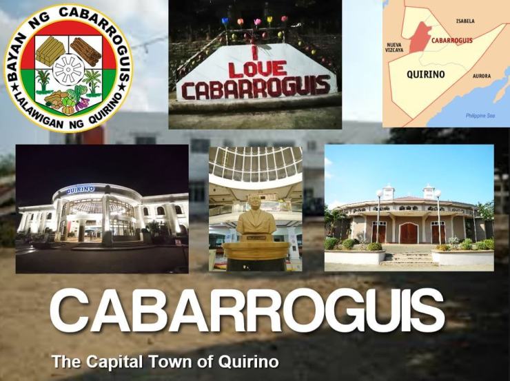
NaveMain retabloKalinga is a landlocked province in the Philippines situated within the Cordillera Administrative Region in Luzon.Its capital is Tabuk and borders Mountain Province to the south, Abra to the west, Isabela to the east, Cagayan to the northeast, and Apayao to the north.The province’s name is derived from the Ibanag and Gaddang noun “kalinga”, which means “enemy”, “fighter”, or “headtaker”. My 64th province!Tabuk, (Ilocano: Siudad ti Tabuk), officially the City of Tabuk, or simply referred to as Tabuk City, is a 5th class city and capital of the province of Kalinga, Philippines. The name of Tabuk evolved from the word “TOBOG”, the name of a living stream with cool and fresh water flowing from Sitio Paligatto in Barangay Balawag down to the Chico River. The areas traversed by this stream were also called TOBOG. Tabuk came by mistaking letter G for C (Tobog to Toboc) and letter A for letter O, thus Taboc. Then finally in later years, they preferred the spelling from the letters OC to letters UK to form the present T A B U K.The Apostolic Vicariate of Tabuk is a Latin Rite Catholic missionary pre-diocesan jurisdiction in the Philippines covering the provinces of Kalinga and Apayao in northern Luzon.Inside the cathedralQuirino (Ilocano: Probinsia ti Quirino) is a landlocked province in the Philippines located in the Cagayan Valley region in Luzon and named after Elpidio Quirino, the sixth President of the Philippines. Its capital is Cabarroguis.The name “Quirino” itself was ultimately derived from the Latin Quirinus, meaning “armed with a lance.” My 65th province!Elpidio Rivera Quirino (born Elpidio Quirino y Rivera; November 16, 1890 – February 29, 1956) was a Filipino politician of ethnic Ilocano descent who served as the sixth President of the Philippines from 1948 to 1953.Cabarroguis, officially the Municipality of Cabarroguis, is a 3rd class municipality and capital of the province of Quirino, Philippines. The newly created municipality of Cabarroguis was named in honor of the late Congressman of Nueva Vizcaya, Honorable Leon Cabarroguis.Tubikoy is a rice cake made from a mix of tupig, bibingka at tikoy. According from Romulo Dumale, “tubikoy” was made accidentally but turned out to be a delicious product. Ito is made of flour, rice flour, brown sugar, margarine, fresh coconut meat, milk and cheese. It is also important in the process of making tubikoy the choice of coconut to be used, which should be of moderate consistency.
For delicacies and souvenirs within the regions visited, see below articles:


2 thoughts on “North Luzon Arch Solo Trip”