I love maps, foodtrip and church visits. Hence, I had a collection of travel maps bought from National Bookstore and started doing my bucketlist. My curiosity led me commuting from one town to another.
This is where I started: collecting maps
I felt bored that I stayed only in my hometown on weekends, so I opt for other activities outside my comfort zone. Aside from heritage churches, I wanted to see the local town centers, their museums and taste delicacies they have to offer, so I started exploring my home province. However, visiting in one day isn’t enough. Because of this, I visited them in different dates and created routes you can also try.
Calabarzon, formally known as the Southern Tagalog Mainland, is an administrative region in the Philippines, designated as Region IV-A. The region comprises five provinces: Batangas, Cavite, Laguna, Quezon, and Rizal; and one highly urbanized city, Lucena. The region is the most populous region in the Philippines and is also the country’s second most densely populated after the National Capital Region. The name of the region is an acronym of its five component provinces: Cavite, Laguna, Batangas, Rizal and Quezon.
Rizal, officially the Province of Rizal (Filipino: Lalawigan ng Rizal), is a province in the Philippines located in the Calabarzon region in Luzon. Its capital is the city of Antipolo. It is about 16 kilometers (9.9 mi) east of Manila. The province is named after José Rizal, one of the main national heroes of the Philippines. It is bordered by Metro Manila to the west, Bulacan to the north, Quezon to the east and Laguna to the southeast. The province also lies on the northern shores of Laguna de Bay, the largest lake in the country. Rizal is a mountainous province perched on the western slopes of the southern portion of the Sierra Madre mountain range. Antipolo serves as the provincial capital since 2020, having been an administrative center since 2009 with the capitol located in the city. Previously, Pasig served as the capital, a designation it retained even after becoming part of the National Capital Region in 1975. The province is a part of Greater Manila Area. It is the 5th largest province in the Philippines in terms of population. My beloved home province. Hence, my 1st Province!
Map of Rizal Province in the 1960s. It shows a still-born Metro Manila with only four local government units: Manila, Quezon City, Pasay City and San Juan. Imagine if Rizal province stayed like this until now, it will still be the premier, most populous and richest in our country.
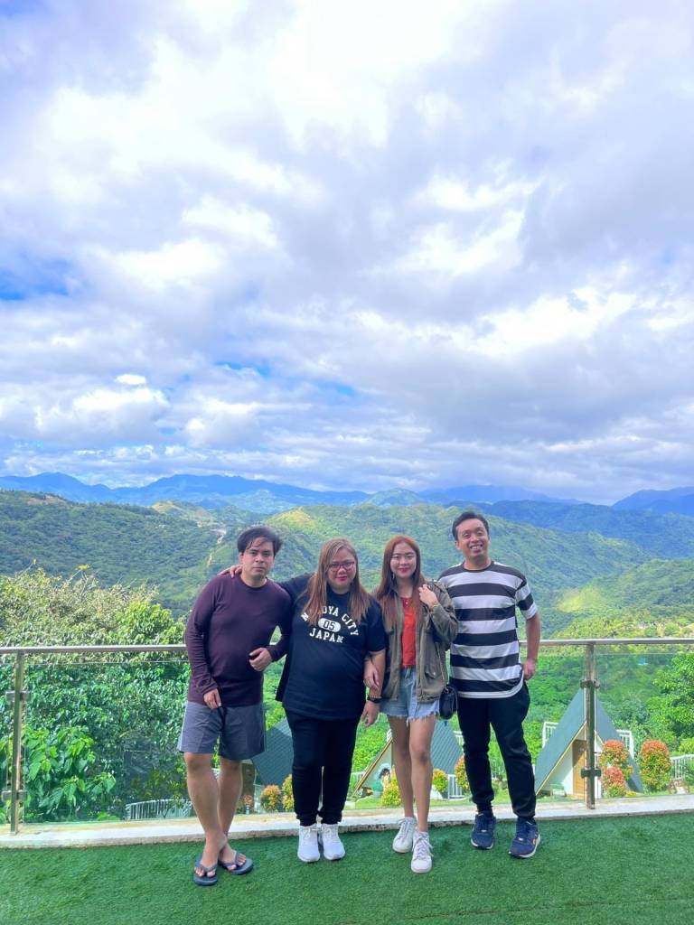
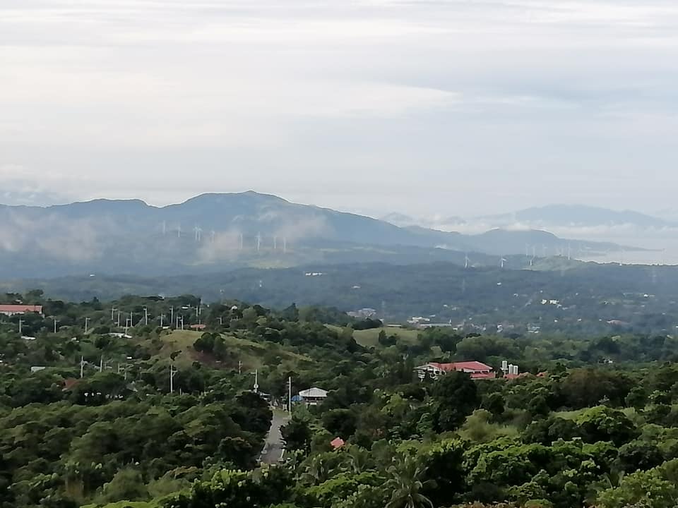
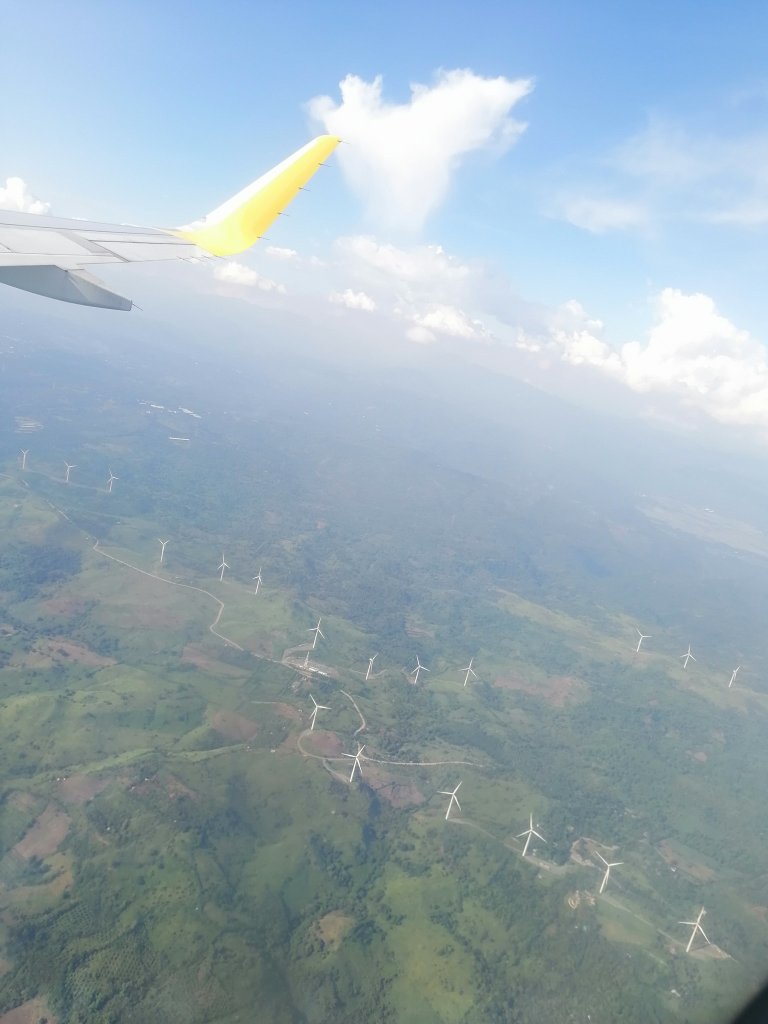
Treasure MountainCielo Alto Place with Sierra Madre Mountain Range in the backgroundMountain range with windmillsMount BatolusongMount DaraitanThe Sierra Madre is the longest mountain range in the Philippines. Spanning over 540 kilometers (340 mi), it runs from the province of Cagayan down to the province of Quezon, forming a north–south direction on the eastern portion of Luzon, the largest island of the archipelago. It is bordered by the Pacific Ocean to the east, Cagayan Valley to the northwest, Central Luzon to the midwest, and Calabarzon to the southwest. Some communities east of the mountain range, along the coast, are less developed and so remote that they could only be accessed by taking a plane or a boat.
In this post, I’ll show some tourist destinations I visited in Rizal thru infographics per municipality/city. I’ll post here in my #project81 the articles related to each province.
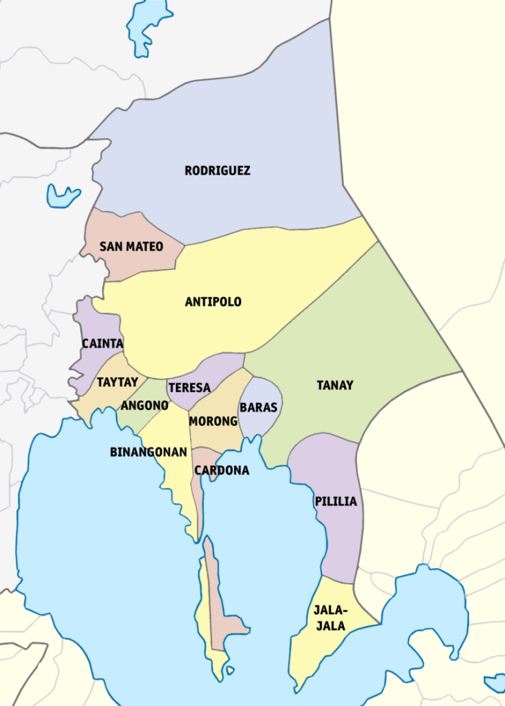
Rizal comprises 13 municipalities and 1 city. Tanay, my hometown, is on the eastern edge of the province.
Town-hopping by the lake: Jalajala-Pililla-Tanay-Baras-Morong-Cardona-Binangonan-Angono-Taytay-Cainta
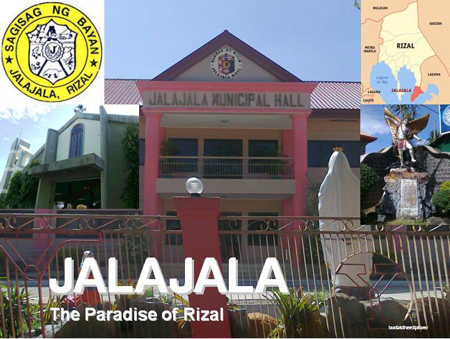
Jalajala (also spelled as Jala-jala), officially the Municipality of Jalajala (Tagalog: Bayan ng Jalajala), is a 4th class municipality in the province of Rizal, Philippines. It is the least populated municipality in the province. What is now the town’s Barangay Punta was the seat of an earlier settlement later known as Halaán. During the summer from April to May, the shores of Laguna de Bay along Punta would be filled with small shellfish locally known as halaán. Another folk etymology is that Jalajala stems from an endemic breed of boar called berk jala, which is abundant in the wilds around the town and is depicted on its seal. As with the other story, a Spaniard asked the Tagalog-speaking natives the place’s name, and the locals’ interjection of “hala-hala” (possibly a hunting chant) was taken by the Spaniards to be their answer.
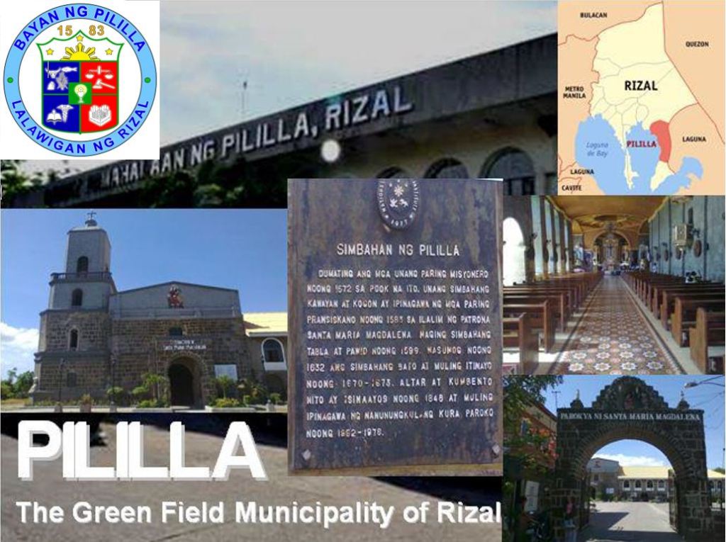
Pililla, officially the Municipality of Pililla (Tagalog: Bayan ng Pililla), is a 1st class municipality in the province of Rizal, Philippines. It is surrounded by farms, small mountains, plains, and trees. Pililla is known as the Green Field Municipality of Rizal. Pilang Muntî was the pre-Hispanic name of the settlement, ruled by a certain Salyan Maginto. His dominion covered the modern towns of Baras, Tanay, Pililla, and Jalajala. It was referenced as “muntî” (“small”) in contrast to the nearby, much larger town of Pila in the province of Laguna.
The “Pililla, Rizal” Wind Energy Service Contract granted to Alternergy Philippine Holdings Corporation (APHC) covers an area of 4,515 hectares under Department of Energy WESC NO. 2009-09-018. Phase 1 of this project is a wind farm in Barangay Halayhayin in Pililla, Rizal, Philippines. The wind farm is being undertaken by Alternergy Wind One Corporation.
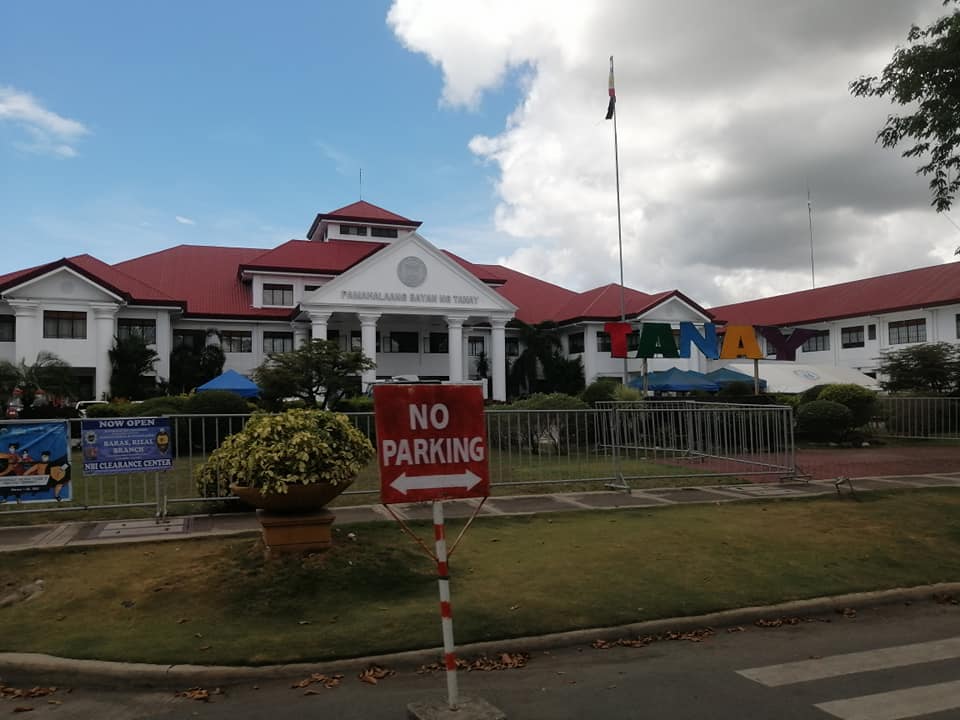
Tanay, officially the Municipality of Tanay (Tagalog: Bayan ng Tanay), is a 1st class municipality in the province of Rizal, Philippines. Tanay is located 37 kilometres (23 mi) from Antipolo and 54 kilometres (34 mi) from Manila. It contains portions of the Sierra Madre Mountains and is bordered by Antipolo in the north-west, Baras, Morong and Teresa in the west, General Nakar (Quezon Province) in the east, and Pililla, Santa Maria (Laguna province) as well as the lake Laguna de Bay in the south. It is the epicenter of the Tanay Tagalog dialect, which has the deepest modern Tagalog words in the Tagalog language and is the only endangered Tagalog dialect.
Tanay was founded as a separate pueblo (town) in 1606 under the name “Monte de Tan-ay“. In 1620, administration was moved to San Antonio (now called Inalsan or Pantay) and Tandang Kutyo. In 1638, the town was burned during an uprising of Chinese living in the area, and the town was rebuilt in 1640 at the present day location.
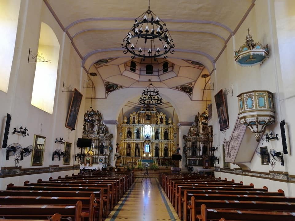
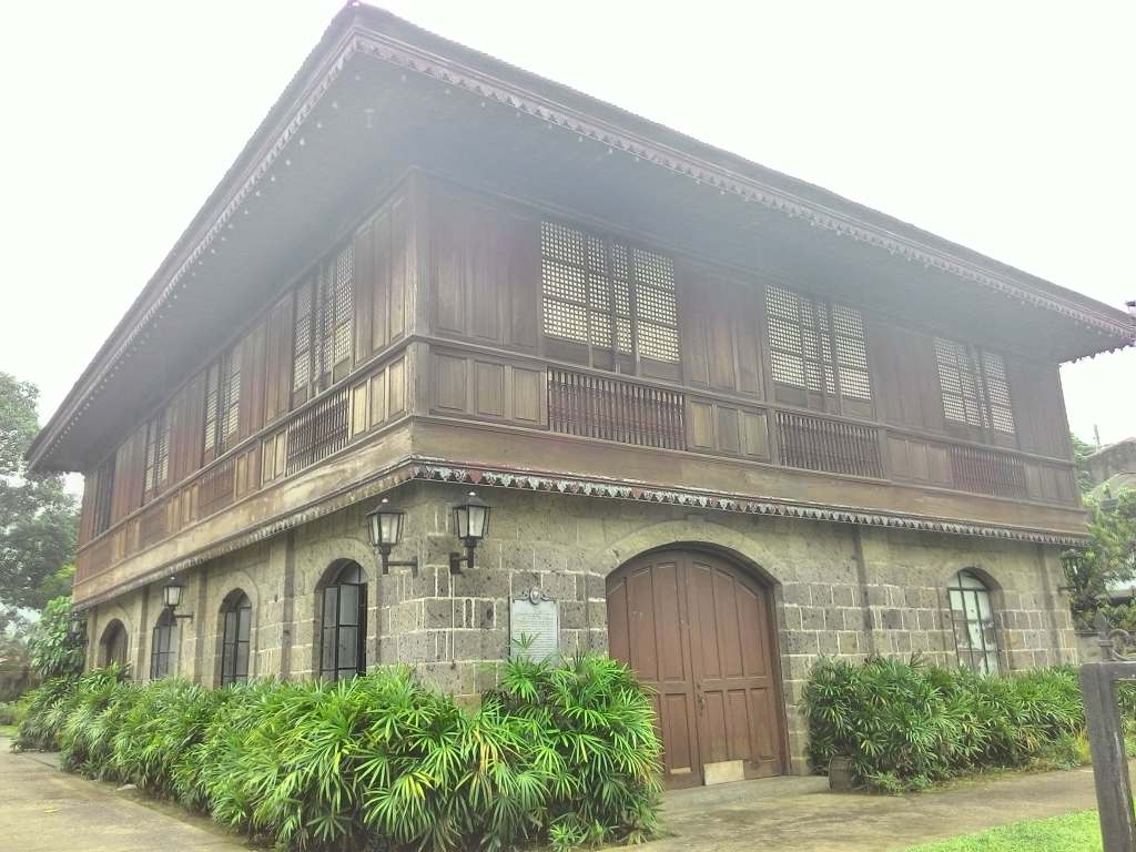
San Ildefonso de Toledo Parish Church (Spanish: Iglesia Parroquial de San Ildefonso de Toledo), commonly known as the Tanay Church, is a Roman Catholic church located in the town of Tanay, Rizal in the Philippines. The construction of the present church was begun in 1773 and was completed after ten years in 1783. In 2001, it was declared as a National Cultural Treasure Church by the National Commission for Culture and the Arts. It is also among the seven Jubilee churches of the Diocese of Antipolo.
Tanay’s economy has been boosted by its natural resources and nature’s allure. Post-pandemic period, many restaurants popped up along Marilaque Highway with majestic views of Sierra Madre mountains and Laguna de Bay. Hence, daytrippers in bicycles and motorcycles flock our town every weekends. There are various activities to try in Tanay, Rizal. There are adventure camps, glamping campsite, staycation sites, cafe and restaurants with beautiful sceneries, and aesthetic photography sites. To mention some of them, here are the some tourist spots in my hometown:
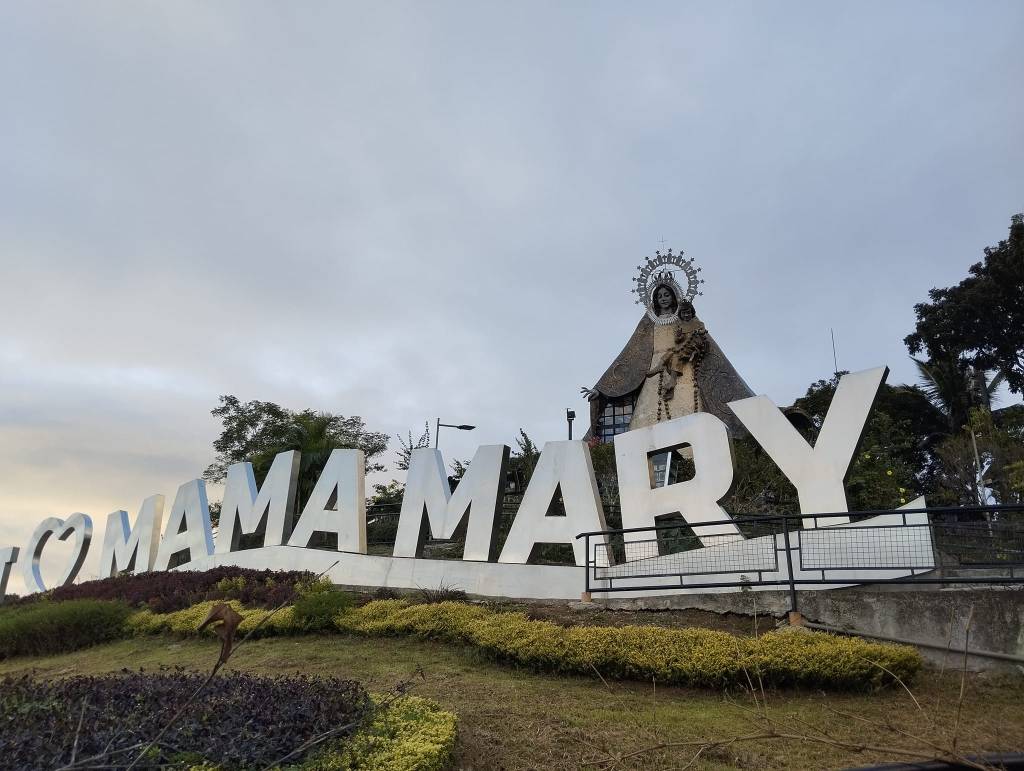
Regina Rica – most Filipinos are Catholics, and this place is one of the best places to go if one want to appreciate the Mother Mary statue and different activities like candle-lighting and pilgrim sites. Most visitors find the place worth the visit and emotional.Mount Daraitan and Tinipak River – these tourist spots are for the adventurous ones who love to trek and hike. The place is also for the nature-wanderers because it features clean waters and majestic sceneries.
Daranak Falls is a waterfall located in the municipality of Tanay, and it’s one of the most popular tourist attractions in the province of Rizal, Phiilippines. Daranak Falls came from the Tagalog word “Dadanak“which means “to flow“, shortened form of “Dumaranak“. The latter word was used to describe the flowing water of the falls. Another origin says that it may also came from the word phrase “Dadanak ang dugo” its directly translated “the spilling of blood“.
Treasure Mountain – it is a spot to appreciate the Sierra Madre Mountain Range and with the right-timing the famous Sea of Clouds of Tanay. To top it all up, visitors don’t need to hike to go here. Tents may also be used here for overnight glamping.
Budbod fried rice originated in the province of Rizal. It is a fried rice, usually colored with soy sauce or the likes, topped with scrambled egg, onion spring, tomatoes and meat or fish. It is a one meal dish. When in Tanay, visit BNK for this sumptuous offering.
Baras, officially the Municipality of Baras (Tagalog: Bayan ng Baras), is a 4th class municipality in the province of Rizal, Philippines. Baras is 32 kilometres (20 mi) from Antipolo and 49 kilometres (30 mi) from Manila. Baras is also the home of the Philippines’ native martial arts’, Sikaran. This ancient martial art was popular among the farmers in the village of Bara even before the Spanish conquest of the Philippine Archipelago in 1521. Hari Osias Banaag, founder of the Global Sikaran Federation and diplomat for the traditional game, attended and was warmly received at the UNESCO Collective Consultation Meeting on the Preservation and the Promotion of Traditional Sports and Game (TSG). Hari Osias Banaag is an appointed member of Ad hoc Advisory Committee Traditional Sports and Games, UNESCO(TSG). Sikaran comes from the root word sikad which means kick in Tagalog, Capampangan (e.g. sikaran daka – “I’m going to kick you”), as well as Cebuano (e.g. “sikaran tika”).
The Masungi Georeserve is a conservation area in the Philippines situated in the southern Sierra Madre range in Baras. It centers on the geological formations of Masungi Rock, at an elevation of 640 metres (2,100 ft). In 1993, the Masungi Rock and its vicinity was proposed to be declared as a Strict Nature Reserve and Wildlife Sanctuary. It has been a popular destination for hikes and day trips from Manila and started development towards Geopark status.
Morong, officially the Municipality of Morong (Tagalog: Bayan ng Morong), is a 2nd class municipality located in the province of Rizal, Philippines. The town is also known for promoting education as its priority, with the vision “Una Ang Edukasyon” (Education First). During the early-1970s and early-1990s, Morong became a center of education with students from nearby towns of Rizal coming to study in the numerous academic institutions situated in the town. Some popular town attraction are the St. Jerome’s Parish Church built in the Spanish Era as well as the featuring side dish called balaw-balaw. Morong is 28 kilometers (17 mi) from Antipolo and 45 kilometers (28 mi) from Manila. On January 16, 1572, Captain Juan Maldonado, a trusted officer under Martin de Goiti, a Deputy of Miguel Lopez de Legaspi, came to a thriving community by a river while leading a Spanish contingent exploring the areas East of Manila. They named the community, Moron, after a township in Spain. This happened almost a year after Martin De Goiti occupied Manila after routing the forces of Rajah Soliman (Sulayman).
Cardona, officially the Municipality of Cardona (Filipino: Bayan ng Cardona), is a 3rd class municipality in the province of Rizal, Philippines. Cardona is part of the 2nd Congressional District of Rizal. Cardona is 23 kilometres (14 mi) from Antipolo and 40 kilometres (25 mi) from Manila. With the continuous expansion of Metro Manila, the municipality is the easternmost part of Manila’s built-up area. In 1855, Cardona was created as a town of the District of Morong, with boundaries set in 1857. Later in June 1901, Cardona formed part of the newly created Province of Rizal through Act 137 promulgated by the Philippine Commission. In 1903, Act 942 annexed the town to the Municipality of Morong. Eleven years then, the Executive Order 108 issued by Governor-General Francis Burton Harrison has established the town as an independent municipality. An oral folklore tells how the name “Cardona” was derived from the Spanish word “caldo” referring to a native rice broth. Supposedly, a stranger walking through the street of the town happened to ask the name of the town from a native, who at that time was enjoying a bowl of hot “caldo”. Thinking that the stranger was inquiring as to what he was eating, the native answered “Sapao! Caldo!”
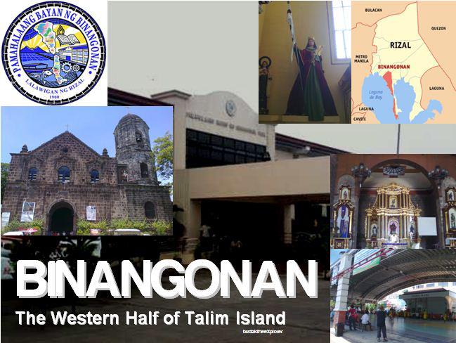
Binangonan, officially the Municipality of Binangonan (Tagalog: Bayan ng Binangonan), is a 1st class urban municipality in the province of Rizal, Philippines. A thriving fish port and fishing industry is found in Binangonan, having a long coast line facing Laguna de Bay, including the western part of Talim Island. The plant of Rizal Cement and Grandspan are in Binangonan as well. Their main livelihood are fishing and farming. With the continuous expansion of Metro Manila, Binangonan is now part of Manila’s built-up area which reaches Cardona in its easternmost part. It is claimed that the binañgonanmeans “the first town established along the lake“, in reference to a legend that tells of how the towns around Laguna de Baý were named. More likely however is that binañgonan refers to a place from where someone or something rose, based on the definition of binangunan in Tagalog. The name of the town in the colonial era (as of 18th c.) was “Binangonan de los Perros” (Binangonan of the Dogs), that etymology might have something to do with dog breeding or hunting.
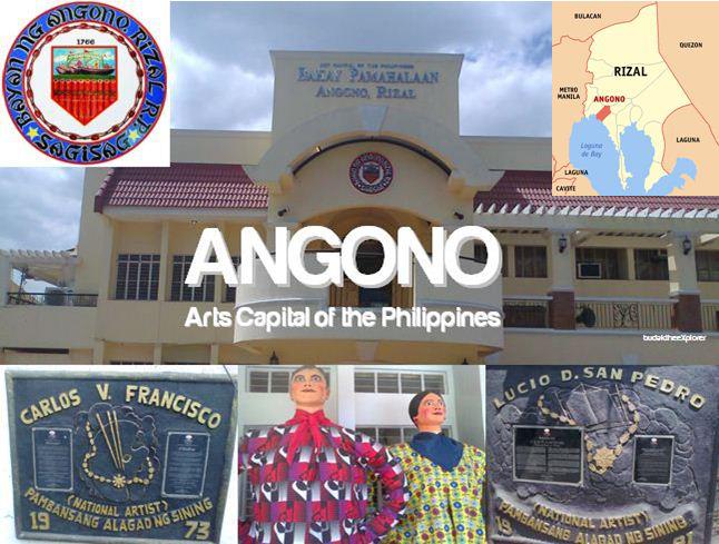
Angono (officially the Municipality of Angono (Tagalog: Bayan ng Angono), is a 1st class urban municipality in the province of Rizal, Philippines. It is best known as the “Art Capital of the Philippines”, being the hometown of national artist for music Lucio San Pedro and national artist for visual arts Carlos “Botong” Francisco, as well as the site of the Angono Petroglyphs, the oldest known work of art in the Philippines. First created as a pueblo in 1766, Angono was a barrio of its neighboring town Taytay and Binangonan before it was legally proclaimed an independent municipality in 1938 by then President Manuel L. Quezon.
The name “Angono” was derived from the myth of Panguno which comes from the word “Ang nuno” which means “The Dwarf“.
The Higantes Festival is a local festival held annually in Angono, Rizal, Philippines, where hundreds of giant papier-mâché puppets are paraded, representing the common people’s mockery of the bad hacienda (land) owners of the past during Spanish colonial rule. It has evolved into also celebrating the feast of Pope St. Clement I, every 22 and 23 November. “The three old higantes of Angono consists of the family of giants – the father, mother and child higante, they traditionally add color and fun during the fiesta celebration.”
MINALUTO – a feast of pork and chicken adobo, seafoods, vegetables, crispy alagaw, burong balaw-balaw, etc.; “a Filipino take on the paella”.
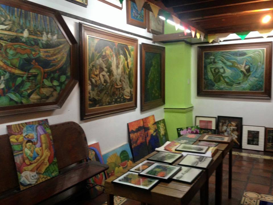
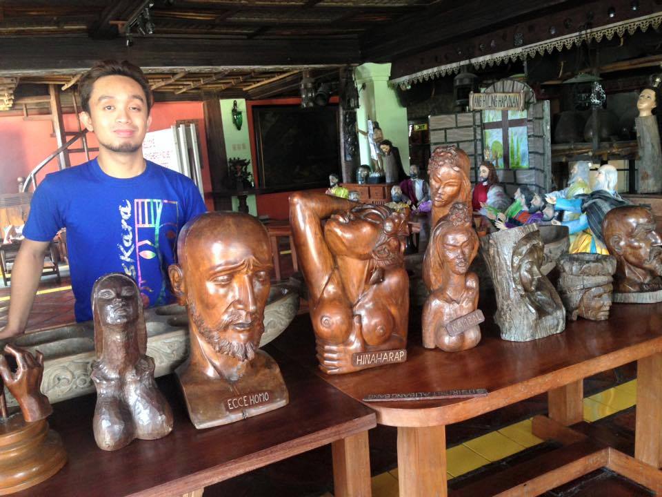
The Balaw Balaw Restaurant in Angono is home of artist Perdigon Vocalan’s art. His paintings, sculptures and food is a local cultural treasure. The restaurant’s name came from Balao-balao, also known as burong hipon (“pickled shrimp”), a a Filipino condiment of cooked rice and whole raw shrimp (esp. Alamang) fermented with salt and angkak (red yeast rice). Once stir-fried, it can be eaten as is with rice or used as a dipping sauce for grilled or fried dishes. Depending on the salt content, it is fermented for several days to weeks. The lactobacilli involved in the fermentation process of the rice produces lactic acid which preserves and softens the shrimp.
As Angono’s favorite delicacy, the fried itik is actually cooked just like “chicken adobo,” allowing its meat to soften and absorb the flavors of the garlic, pepper, vinegar, and soy sauce, before it is fried into golden brown perfection.
Taytay, officially the Municipality of Taytay (Tagalog: Bayan ng Taytay), is a 1st class urban municipality in the province of Rizal, Philippines. It is also known as the Garments Capital of the Philippines. Conurbanated with Metro Manila, it is bounded by Cainta on the north, Pasig and Taguig on the west, Antipolo in the east and Angono on the south. While economically, demographically and politically qualified, plans to convert it into a city was set aside, pending social and administrative reforms in the municipality. It is the 2nd most populous municipality in the country, after Rodriguez, Rizal. The name “Taytay” may have derived from the word taitai(similar with the Kapampangan word tete), which means bridge to the Negrillos (Aetas) that wandered in Taytay and Antipolo, according to a claim. In 1579, Taytay was formally established as a town and Church in a symbiotic relation, i.e., it presupposes that one could not have existed without the other. Due to incessant flood, the town was relocated to a higher ground. The people followed suit after the church was rebuilt atop a hill. Taytay town was dedicated to Saint John the Baptist and christened “San Juan del Monte” [which means “Saint John of the Mountain”]. “San Juan” got the “del Monte” tag in reference to the hilly terrain of the new relocation site of the town. Nevertheless, the townspeople continued to call their town Taytay, and Taytay it has remained to this day. This is the same location where the present St John the Baptist Parish Church still stands.
The Minor Basilica of St. John the Baptist, commonly known as Taytay Church, is a Roman Catholic church located in Taytay, Rizal, Philippines. Franciscan missionaries first arrived to establish a parish in Taytay in 1579 and built a chapel made of light materials near the shores of Laguna de Bay named “Visita de Santa Ana de Sapa,” dedicated to its patron saint, John the Baptist. On January 27, 2024, it was announced by parish priest Fr. Pedrito Noel Rabonza III that Pope Francis had granted the parish church an elevation to the title of minor basilica. This coincided with the declaration of the diocese’s cathedral, Antipolo Cathedral, as the first international shrine in Southeast Asia.
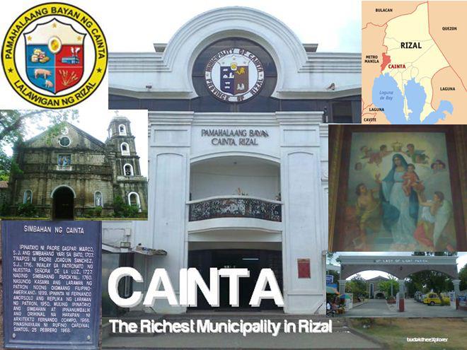
Cainta, officially the Municipality of Cainta (Filipino: Bayan ng Cainta), is a 1st class urban municipality in the province of Rizal, Philippines. It is one of the oldest municipalities in Luzon (founded on August 15, 1571). Cainta serves as the secondary gateway to the rest of Rizal province from Metro Manila. With the continuous expansion of Metro Manila, Cainta is now part of Manila’s conurbation, which reaches Cardona in its easternmost part and is therefore one of the most urbanized towns. One legend has it that there was an old woman called “Jacinta” who was well known not only in her own native town but also in the neighboring towns. In her youth, she was very popular because of her great beauty, kindness, and wealth. Although she was a member of a very rich clan, she showed generosity of heart to the poor. Hence, she became very much loved and respected. Jacinta grew to be an old maid because after her sweetheart got sick and died, she never fell in love with anyone else. When her parents died and she was left alone in the house, she continued her charity work. She gave alms to the long line of beggars who came to her, and housed and took care of the orphans and children in the streets. In her old age, she was still very popular and was fondly called “Ka Inta” (“Ka” referring to a term of respect for the elderly, as well as a term for the feeling of comradery or “kapwa” feeling for someone). Cainta became an independent town in 1760. During the brief British occupation of Luzon (1762–1763), part of its British India troops known as Sepoys lived and intermarried with the natives in one of the town’s barrios. The Indian left a culinary legacy in the spicy and highly seasoned dishes that are now part of mainstream Cainta cuisine. Cainta became part of Tondo (starting 1763) but separated in 1883 and incorporated with the district of Morong.
Cainta is known for its native delicacies, a tradition inherited from nearby Antipolo, which is largely a cottage industry. Dating back to the 15th century, it became the town’s principal source of income for more than four centuries. Suman (rice cake wrapped in banana leaf), latik (boiled down coconut milk used for glazing), coconut jam and the famous bibingka, are but a few of the sweet delights that lure many visitors to this town. During the 20th century, Cainta dazzled the whole country when it baked the biggest rice cake ever and the town became known as the “Bibingka Capital of the Philippines”. Bibingka is believed to have been adapted from the Indian cuisine, an influence from its Sepoy population. It comes from the Indian word bebinca also known as bibik, a dessert made of flour, coconut milk, and egg. The Philippine version is made of rice flour, coconut milk, and salted duck eggs. Butter and sugar are used for glazing after cooking and before serving.
Town-hopping in the interior and highlands: Teresa-Antipolo City-San Mateo-Rodriguez
Teresa, officially the Municipality of Teresa (Tagalog: Bayan ng Teresa), is a 2nd class municipality in the province of Rizal, Philippines. It is situated in the slopes of the Sierra Madre Mountains and is landlocked on four corners by Antipolo on the north, Angono on the west, Tanay, on the east, and Morong, on the south. Contrary to some articles, Teresa is actually a valley surrounded by mountains. The town center is located almost at the center of the valley. In an aerial view of Teresa, one would notice the previously vast expanse of agricultural land bordered by marble-rich mountains. The town is passed by motorists bounded for the more inland towns of Morong, Baras, Tanay, Pililla, and Laguna and Quezon provinces. The town’s festivals are the Turumba sa Mahal na Patron Santa Rosa (held every August 23), Anniversary celebration of town independence (every December 30), and Town fiesta (every 1st Sunday of March). In 1900, the people agreed to change the name from Santa Rosa to “Teresa” in honor of the Spanish lawyer’s mother, Doña Teresa Candelaria.
Antipolo, officially the City of Antipolo (Filipino: Lungsod ng Antipolo), is a 1st class component city and capital of the province of Rizal, Philippines. It is the most populous city in the Calabarzon region, and the seventh most-populous city in the Philippines. It is also the most populated city under the component city status. Its higher elevation than that of Metro Manila affords it a scenic view of the metropolis, especially at night. The Hinulugang Taktak National Park, which was once a popular summer get-away is being restored to become again one of the city’s primary attractions because it was devastated by a typhoon. The city was named after the breadfruit tree (Artocarpus blancoi) locally known as Antipoloor Tipulo, which was in abundance in the area.
Hinulugang Taktak Protected Landscape, also known as Hinulugan Taktak, is a protected area located in Rizal, Philippines. Initially assigned as a recreation area, the waterfall area has been designated as a national park by virtue of Republic Act No. 6964 in 1990. Ten years later, it became a protected landscape in accordance to Proclamation No. 412. It is being managed by the Department of Environment and Natural Resources and the Rizal Provincial Government. As of 2003 and 2004, Hinulugang Taktak is the second most popular national park in the Philippines in terms of number of visitors.
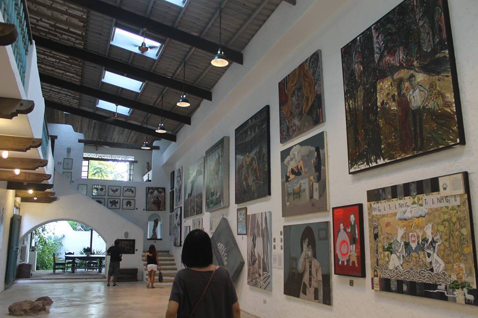
The International Shrine of Our Lady of Peace and Good Voyage (Filipino: Pandaigdigang Dambana ng Birhen ng Kapayapaan at Mabuting Paglalakbay; Spanish: Santuario Internacional de Nuestra Señora de la Paz y Buen Viaje), popularly known as the Antipolo Cathedral (Filipino: Katedral ng Antipolo; Spanish: Catedral de Antipolo) and alternatively known as the Immaculate Conception Parish (Filipino: Parokya ng Kalinis-linisang Paglilihi), is a Roman Catholic cathedral in Antipolo, Philippines. It enshrines a venerated Black Madonna image of the Blessed Virgin Mary under the title of Our Lady of Peace and Good Voyage (Spanish: Nuestra Señora de la Paz y Buen Viaje), and serves as the seat of the Bishop of Antipolo. The shrine attracts millions of pilgrims annually, especially during the pilgrimage season from May to July each year.The Pintô Art Museum is a contemporary art museum complex in Antipolo, Rizal, Philippines. The Pintô Art Museum consists of six buildings and stands on 12,000 square meters (130,000 sq ft) of land at the Grand Heights subdivision in Antipolo, Rizal. The buildings are not air-conditioned and rely on open-air ventilation to preserve its collection. Tony Leaño, a Saling Pusa member designed the buildings in an organic and eclectic style. The complex has two museums – one for contemporary art and another for indigenous art. It has an academy for literature, visual and performing arts. Pintô also has a cafe, an arboretum. The 2000 square meter arboretum has 500 indigeneous plant species as of 2021. The museum hosts the collection of Joven Cuanang. Works of Saling Pusa members would be featured in the museum.
Its locally grown mangoes and cashews are popular among tourists, as well as suman – a local delicacy made out of glutinous rice.
San Mateo, officially the Municipality of San Mateo (Tagalog: Bayan ng San Mateo), is a 1st class urban municipality in the province of Rizal, Philippines. It is bordered by Quezon City to the west, Marikina and Antipolo to the south, and by the Municipality of Rodriguez to the north. San Mateo is approximately 24 kilometers (15 mi) east of Manila and 11 kilometers (6.8 mi) north of Antipolo, the provincial capital of Rizal. Conurbated to the urban agglomeration of the Greater Manila Area, San Mateo is one of the fastest-growing municipalities in Rizal Province and a commuter hub to Metro Manila. San Mateo is the home of the miraculous image of Our Lady of Aranzazu (Nuestra Señora de Aranzazu).
Rodriguez, officially the Municipality of Rodriguez (Tagalog: Bayan ng Rodriguez), is a 1st class urban municipality in the province of Rizal, Philippines. It the most populous municipality in the country. Pending an affirmation through plebiscite, Republic Act No. 11812 repealed Batas Pambansa Blg. 275 and intend to revert to its original municipal name Montalban. It is the northernmost town in the province and comes after San Mateo, Rizal, and Quezon City coming from Metro Manila. The town is located on the slopes of the Sierra Madre mountain range and it is the largest town in Rizal province with an area of 312.70 square kilometers (120.73 square miles). It is also the location of the Montalban Gorge that is associated with the Legend of Bernardo Carpio. The gorge forms part of a protected area known as the Pamitinan Protected Landscape. The municipality borders San Mateo and Antipolo, Rizal on the south, Norzagaray and San Jose del Monte, Bulacan on the north, Quezon City and Caloocan on the west and General Nakar, Quezon on the east.
The town’s former official name of Montalban derives from the Spanish word monte, which translates to “mountain,” in reference to the numerous hills found within and surrounding the town. A common name for the municipality up to the present, it was its official name from its founding in 1871 until 1982 when the Batasang Pambansa officially renamed it to Rodriguez under Batas Pambansa Blg. 275 in honor of Eulogio Rodriguez, a native of the municipality who served as its first municipal president and Philippine Senate president.
For detailed posts about visita iglesia in Rizal, click on below link:


5 thoughts on “Rizal: The Premier Province next to Metro Manila”